
TODAY
After a bout of morning clouds, we’ll see partly cloudy conditions this afternoon. A shower is possible, but not probable (20%). It’ll be warm, with a high in the mid-80s.
THURSDAY/FRIDAY
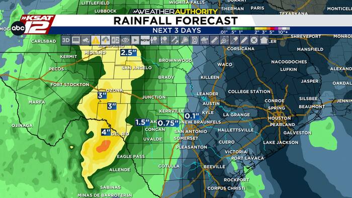
Moisture from Tropical Storm Vance will get pulled into West Texas on Thursday and Friday. While this could bring some passing showers to the area, the deepest moisture will stay west of San Antonio. Some heavy rain is possible for areas along the Rio Grande. Do expect plenty of clouds, before clearing takes place on Saturday.

HALLOWEEN
Halloween will feature isolated, pop-up downpours during the afternoon, however, quieter weather should take over by trick-or-treat time. Temperatures will be in the 70s during the evening hours.

SOMETHING TO WATCH
Next week, a potent storm system will push a front into the area. This could bring a round of storms and cooler weather for Election Day. Stay tuned for updates!


